
Ikryaninsky Municipal District, Astrakhan Region
Ikryaninsky District
Key facts:
- Area: 199.67 km²
- Population: 48,058
- District centre: Ikryanoye village
- Average salary: RUB 40,389.7
- 1 vocational education institution
Landmarks:
- Lotus fields
- Museum of the History of Fishing
Key industries:
Agriculture
Transportation and storage
Industrial production
Tourism
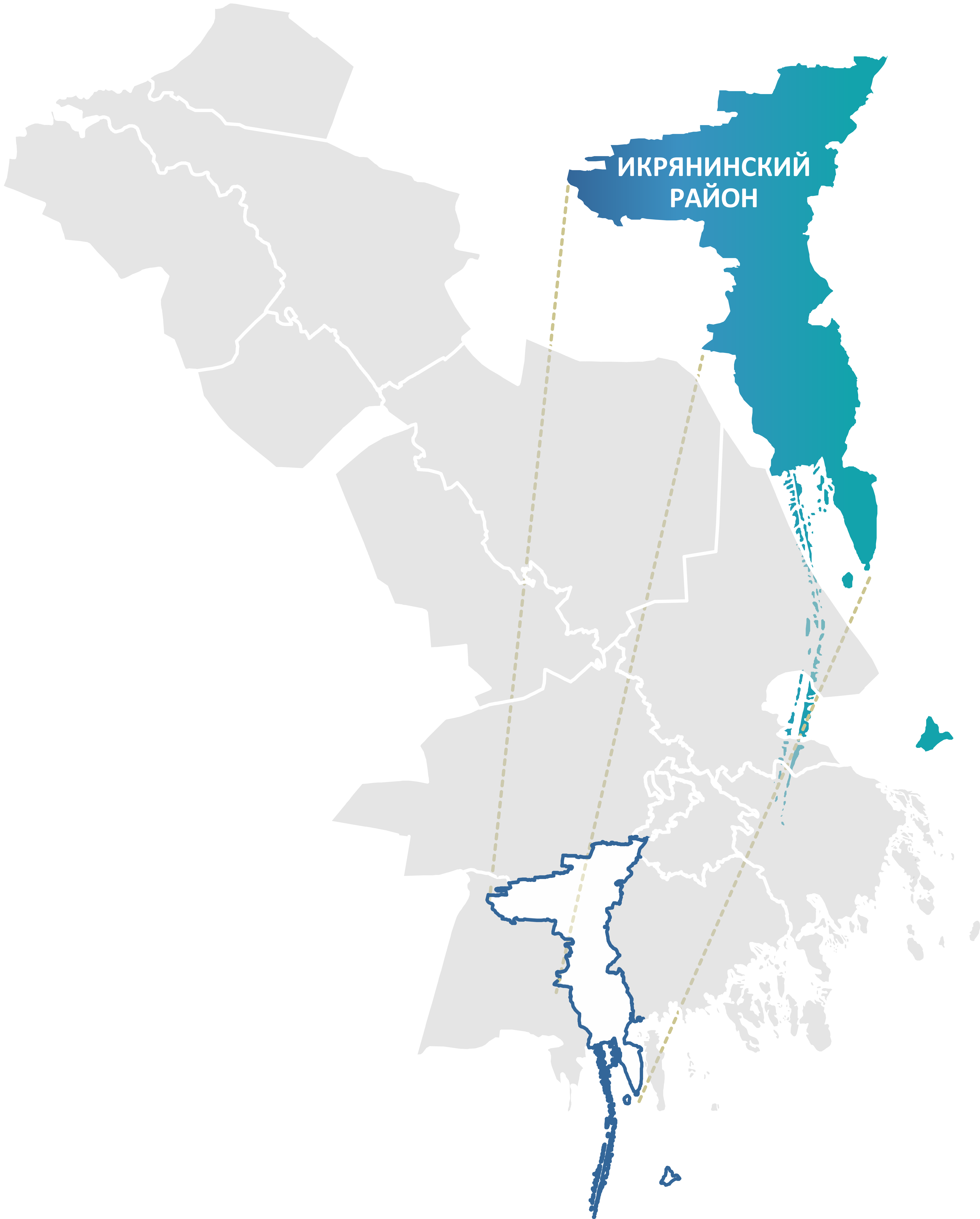
Ikryaninsky District is located in the south-western part of the Astrakhan Region. To the north it borders Narimanovsky District and the city of Astrakhan, to the east and south-east — Privolzhsky and Kamyzyaksky districts, and to the west — Limansky District. The southern and south-eastern borders of the district are washed by the Caspian Sea.
The district's main natural wealth is its water resources. The Volga delta with its numerous channels, ilmens and lakes creates a unique ecosystem rich in fish and aquatic vegetation. Fields of blooming lotus and reeds are located here, which makes these places picturesque and attractive to tourists and researchers.
The economy of Ikryaninsky District is diversified and demonstrates steady growth. The economic driver is the "Krasnye Barrikady" production site (Southern Centre for Shipbuilding and Ship Repair), specialising in shipbuilding.
Agriculture remains the traditional foundation of the district's economy, showing stable annual growth. Farmers harvest rich crops of vegetables, potatoes and melons. A large greenhouse complex makes a significant contribution, increasing its output of tomatoes and cucumbers year by year — in the latest reporting period gross harvest here rose substantially. Several meat poultry farms operate in the district.
The district has traditionally been famous for its fishing industry. Over the last five years the number of farms engaged in aquaculture has doubled.
.png)
